Morgan Sjogren ➸ Running Bum

Writing to protect the soul of wild spaces

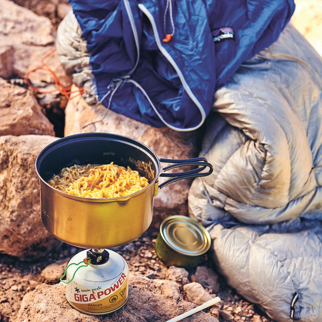
This story originally appeared in The Gulch Magazine Issue 10.
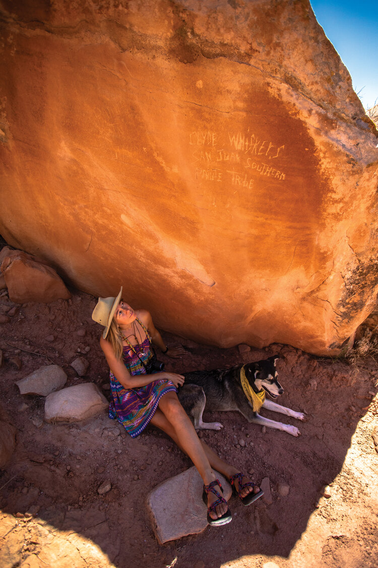
DSC_4737 copy.jpg

Look Mr. Whiskers – we found your name again!” We stop to examine another trailside inscription along the sandstone flanking Navajo Mountain.

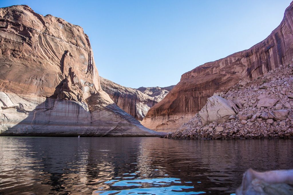
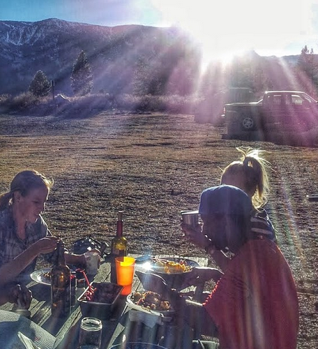
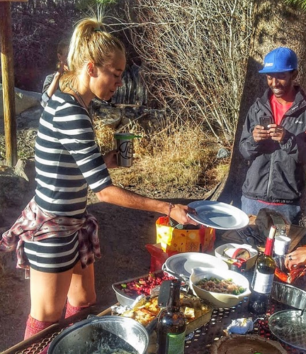
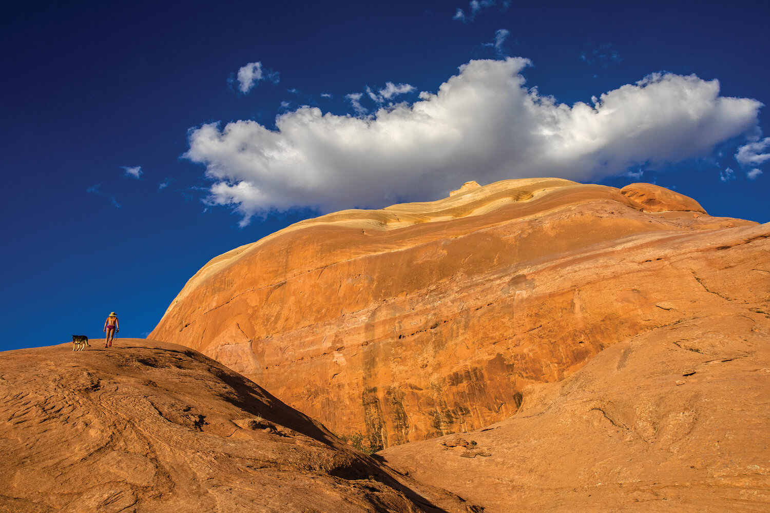
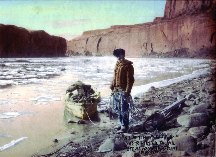
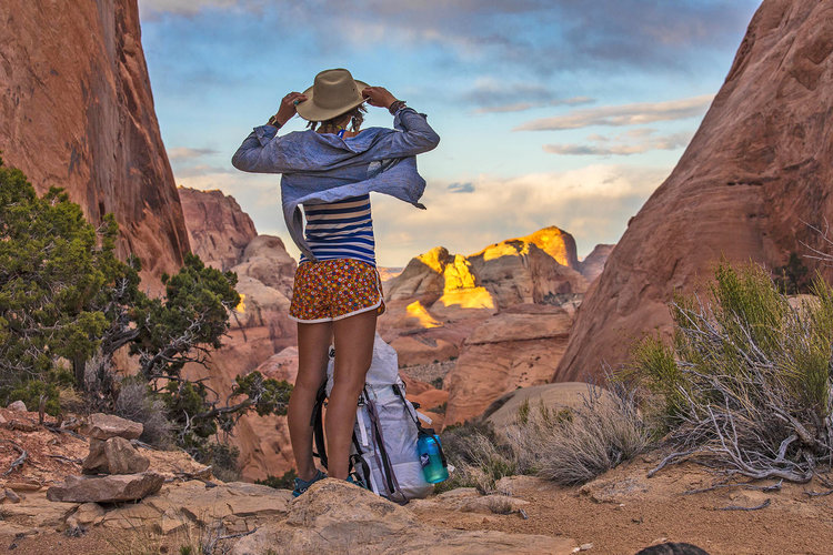
Earlier this spring, my companions Steve and a husky mutt named Phil joined me on a backpacking trip circumnavigating Navajo Mountain. Equipped with a list of historic inscriptions we carefully gazed at canyons walls and boulders in our backcountry game of Where’s Waldo. We focused on inscriptions from the Bernheimer Expeditions, funded by a wealthy New York businessman named Charles Bernheimer who toured the Four Corners region by horseback every summer from 1915-30. We playfully nicknamed each other after the expedition party members: I assumed the role of guide and seasoned desert rat John Wetherill (“Johnny”); and Steve jovially took on the persona of Bernheimer (“Berny”), the self-proclaimed tenderfoot cliff dweller from Manhattan. On an idyllic spring day, with oak buds leafing out before our eyes, we came across a beautiful John Wetherill inscription carved with precise letters on a lavishly varnished sandstone wall deep inside a tributary of Glen Canyon. It was here that we first saw the name CLYDE WHISKERS, faintly scratched in an angular scrawl reminiscent of Ralph Steadman alongside the John Wetherill engraving.

We joked that Phil’s nickname should be Clyde Whiskers so he wouldn’t feel left out from our historical role-playing. Without any clue as to who this person was, we initially perceived it a likely act of vandalism, as is so despondently common across the Southwest. Then we saw Clyde Whiskers carved again on a trailside boulder. And then again on other canyon walls, in a cave and later on boulders farther north. Vandalism tends to be a singular occurrence – two lovers carving their initials in stone or a drunk house-boater memorializing his spring break – but both the frequency and time span of these inscriptions was certainly impressive. Many of the Clyde Whiskers inscriptions were dated within the 50-year cut-off that deems such objects historical versus vandalism. Each time I saw Clyde’s name, or that of a historic explorer, or an ancient handprint, I contemplated what it is about human nature that compels us to leave our names, our handprints, our mark on the world around us?

 As we hiked behind Navajo Mountain our curiosity about Clyde rose each time we came across his name. Hauling heavy packs, we’d entertain each other with imaginative tales about “the legend of Clyde Whiskers” as Mr. Whiskers (Phil), whose nickname stuck, trotted with his tail swinging ahead of us along the slick rock domes and narrow canyons. Perhaps Clyde was a sheepherder or a bandit itching for the thrill of leading detectives into the canyon maze; maybe he just wanted to practice his signature. If only the writings on the walls could talk and tell us their stories.

I’ve heard the name Whiskers used in the area only once before – a canyon named Whiskers Draw (formerly First Valley). The only published explanation for the name I’ve found is vague, “First valley had been the site of an incident between a dairy herder named Willard Butt and a Ute Indian named Whiskers. Rancher Butt was alone at his dairy one day when old Whiskers showed up, pulled out a rifle and ordered the farmer to give him dinner. The farmer quickly complied, and to his great relief, Whiskers left pacified. Because of this incident, First Valley is now called Whiskers Draw.” (Blackburn, Fred and Williamson, Ray. Cowboys and Cave Dwellers, 1997. p. 108)

But who was this Whiskers, and was he related to – or even THE – Clyde Whiskers? My imagination often runs wilder than my legs, and these obscure details often lead me to explore new places. So, on a criminally hot afternoon in mid-July, I drive with Phil out to Whiskers Draw, hoping to come across another Clyde Whiskers inscription but certainly not expecting to solve this mystery.

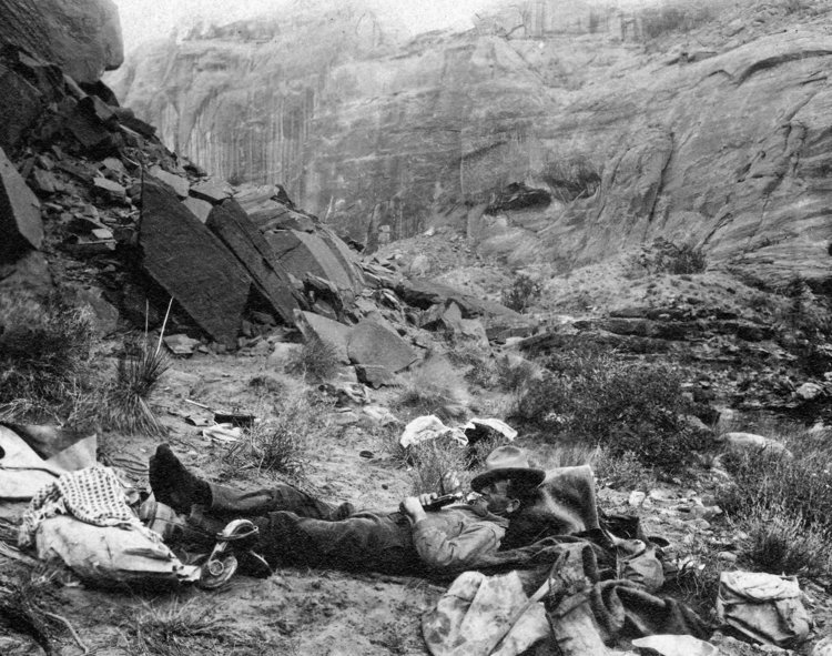
Phil and I walk around the rim of Whisker’s Draw, but his waggly tail and happy panting soon droop along with my own morale. Mid-summer is a brutal time to be out there if you don’t adhere to the well-known desert circadian rhythm: seek shelter and sleep during the day, start making your moves at dusk. Contrary to common sense to avoid the desert in the summer due to scorching temperatures, biting flies and flash floods, it is these times when the desert is its harshest (winter included) that I have had my most profound experiences. We beeline back to the Jeep, down some solar-heated water and leave seeking a place to nap at a higher elevation above Cedar Mesa. Perhaps we will return to Whiskers Draw when the temperatures are cooler tomorrow morning. For the better part of the afternoon, the two of us sleep peacefully in the meadow, and when the temperature finally began to drop, we frolic and run amongst wildflowers and butterflies.

As the sunset behind the shadowed expanse of mesas and mountains, I erect our camp along the ridgeline overlooking the canyon kingdom of Bears Ears and with Navajo Mountain directly before us in the distance. Sitting around a small fire of savory-smelling juniper we wait until the brilliant colors fade before racing to the orange tent to escape the insidious bites of cedar gnats. Blissfully wrapped in each other’s arms, I fall asleep reading a book with my headlamp on. At midnight, I am startled awake. I just dreamt about a man walking around our campsite in the trees with a flashlight. But I noticed there is actually a light moving in the trees. Perhaps nearby campers? My imagination? I want to tell myself that it’s nothing to worry about, that it’s just a bad dream, but what if it’s not?

I gently wake Phil up so I can break down the tent. Fast asleep, he is ambivalent to the situation. He extends his paw out to me, an adorable gesture he makes when he wants to snuggle and hold hands, and I oblige before prodding him to move. When he gets up, the dirt-stained blanket we’ve been sleeping under is covered in dog piss. Yeah, we need to get out of here. Phil wobbles to the Jeep, and I wrongly assume he is just freaked out and tired. He timidly jumps inside and waits while I haphazardly pull apart the tent and stuff it in the back hatch. I get behind the wheel to turn on the ignition and headlights, but it takes me a minute to figure out why I can’t see – then I remember to switch off my headlamp.

Wheels spinning onto the moonlit road, Phil is obviously unwell. He can’t hold his head and body upright or keep his eyes open, and he’s unconsciously drooling and peeing. I drive fearing for his life through the night to get him to a vet and hope he is not as afraid as I am. We stumble into the veterinary office the next morning where, after a series of observations and a panel of blood tests, the vet proclaims her diagnosis, “I think Phil ate some drugs. His symptoms are right in line with eating a psychedelic substance.”

It all seems implausible given that I didn’t have a single mind-altering substance with me, the remote location and the fact that the nearest town to Bears Ears doesn’t even sell alcohol. Then I recall a passage from naturalist Ann Zwinger’s Wind in the Rock, the book I was reading when I fell asleep in the tent. “Datura is one of the main drug plants of the Southwest, it was used ceremonially by the Indians, who made a decoction of the leaves and stems. Generally used to induce visions and for divination, or simply a prehistoric marijuana.” The terminology and accuracy are outdated, but it sparked the realization that datura does grow rampant at our camp, not to mention the plant’s pods (also hallucinogenic) burst open to disperse and spread seeds on the ground. I look down at Phil’s tipsy black and white body and joke, “So Phil Whiskers, why did you eat the datura?”  I wonder what sort of incredible visions Phil is having right now:

 Phil: I can see things that were hidden before with my eyes closed. Morgan, you missed a bunch of those Clyde Whiskers scratches on the rocks when we were running.  I didn’t bark because I was trying to remember where I buried that piece of pizza you gave me. I never chose the drugs; the datura seeds were in the poop I was eating. Do any of us really choose much? I don’t choose to eat the same dog food every day. You always want to go to really hot places – there is no way you are choosing that. And this invisible Clyde Whiskers guy you keep talking about – is he choosing to hike with us every weekend? No way. We should at least find Clyde and invite him to share my hidden pizza. Actually, I forgot to tell you, I think I saw him in the bushes by our camp last night. Mo, are you listening to me? I can’t talk right now, I can only blink. Listen, dammit!

 Looking into Phil’s eyes, blinking ever so slowly, it’s as if he’s telling me, let’s find Clyde Whiskers. Or maybe that’s just my sleep-deprived delirium. Jacked up on caffeine and adrenaline, there’s no way I can go back to sleep. Phil, however, sleeps off the drugs for the remainder of the day. Instead, I summon my frenetic energy to send out an email search party for Clyde Whiskers amongst my arsenal of Southwest obscura-obsessed friends. Within an hour, I am on the phone with a man who knew Clyde Whiskers.

“I met him towards the end of his life.” I can hardly believe the conversation as Logan Hebner, an anthropologist from Springdale, Utah, recounts his brief encounters with Clyde. My inquisitiveness skyrockets, but before I can ask another question Logan redirects our conversation, “To understand anything about Clyde Whiskers you need to understand what happened to the San Juan Southern Paiutes.”

Bessie Owl, a close relative of Clyde Whiskers. Photo by Michael Plyler, courtesy of USU Special Collections, Merrill-Cazier Library.

The San Juan Southern Paiutes are a semi-nomadic band traditionally based southeast of the San Juan River and extending across the Utah/Arizona border to the land east of the Little Colorado River, in what was formerly known as the Paiute Strip. For a portion of every year, the tribe traveled along a nomadic loop around White Mesa, Douglas Mesa and Allen Canyon – in and surrounding present-day Bears Ears National Monument. The migration around their 9,000 square miles of territory allowed for hunting, foraging, and protection created by the desert landscape.

Bernardo de Miera, of the Domínguez-Escalante Expedition, was the first to document the San Juan Paiutes in this area in 1776. This supports their claim to inhabiting these lands before the Diné arrival during Bosque Redondo in 1867 to evade Kit Carson and The Long Walk. (Hebner, Logan. Southern Paiute: A Portrait. 2010. P. 21-22). During the Glen Canyon Salvage Project in 1960, archaeologist Cristy Turner hypothesized, “It is conceivable that the Paiute living on the north side of Navajo Mountain did so along with what we regard as the Anasazi.” (Turner, Cristy. Notes on the Navajo Mountain Paiute Band. 1960)

In 1907, the Paiute Strip was recognized by the U.S. government as an official reservation, but this recognition was temporary. In the 1920s, the U.S. government began prospecting for oil in the region. According to Logan, “Without consulting or informing the San Juan Paiute, Secretary of the Interior Albert Fall vacated their title to the reservation in 1922 and opened their lands for oil drilling. Fall would gain infamy for becoming the first presidential cabinet member to be jailed, convicted of taking bribes from oil companies in exchange for leases on federal lands in the Teapot Dome scandal that embroiled Warren Harding’s presidency.” (Hebner, p. 21). This particular land grab occurred while the San Juan Paiutes were away from their seasonal territory, the government “assuming” that no one inhabited it.

Logan continues, “The oil companies drilled empty holes and left. A young Navajo graduate from the Sherman Institute began petitioning the government to set aside the Paiute Strip lands again, and initial paperwork referring to ‘the Indians who have always lived here’ was gradually replaced with Navajo. There was a series of meetings, from 1930-32, with the Navajo Tribal Council, regional BIA officials and other federal and state bureaucrats – everyone but the San Juan Paiute. In 1933, the vast Paiute Strip officially became a part of the Navajo Reservation.” (Hebner, p. 22) Logan explains, “Most San Juan Paiutes returned home after their migration season with Diné coming to their homes and telling them to leave, that this is no longer their home, and with papers to prove it.”

It’s not a stretch for one to imagine this line from history being repeated contemporarily as federal lands throughout the Colorado Plateau, all once part of indigenous tribal lands, face reduced protections and eased access for extractive industries via illegal interpretations of the Antiquities Act.

In 1954 the U.S. government terminated the San Juan Paiutes as a tribe, not to officially recognize them again until 1989. Today, the San Juan Paiutes still do not have any official reservation lands despite signing a historical treaty with the Navajo Nation in 2000 that would grant 5,400 acres of land to the tribe if honored by the U.S. government. Most live near the Hopi in Willow Springs and Tuba City, or within the Navajo Nation near Navajo Mountain (formerly known as Paiute Mountain, Kaivyaxaru or Ina’íh bi dzil in Paiute).

Photo by Michael Plyler, courtesy of USU Special Collections, Merrill-Cazier Library

A former Utah river guide in his own nomadic “living out of a white truck in the desert phase,” Logan spent over 20 years listening to and recording the stories of the San Juan Paiutes, compiling them in Southern Paiute: A Portrait (2010). He donates all of the book’s royalties to the tribe, in a sense paying the elders for their stories. Many (including one 107-year-old woman) recall their days of traditional travel, termination as a tribe, as well as the day they were told to leave their homes. Amongst the stories he recorded, Bessie Owl, Clyde Whisker’s relative, lamented, “It really bothers me sometimes, how we lost this land to the Navajo. This land, it’s not Navajo; it’s Paiute. I don’t consider it as a Navajo reservation. It’s a lease, a lease from the government, that’s how I think of it. I wonder about it, always think about how we would ever get the land back, get a reservation of our own. I was happy when we were recognized as the San Juan Tribe. My husband and I went over to be a part of it. It was a happy moment. But after we got recognized, the Navajo only gave us a little portion of land because they were grazing it.” (Hebner, p. 33)

Many of the Paiutes Logan interviewed did not speak any English, which is how he came to know Clyde Whiskers. Not only did he speak English, he was also one of the few Paiutes with a cell phone, and Logan recalls, “He’d call me late at night about his frustrations about what happened to his band of San Juan Southern Paiutes.” A member of the Tribal Council, Logan recalls that he carried, “a regal embossed calling card proclaiming, ‘Let It Be Known by All That Clyde Whiskers Is A Member of The San Juan Tribal Council.”

Contemplating the person behind the inscription. Photo by Stephen Eginoire

“So why do you think Clyde signed his name all over the place?” I ask Logan, and he takes no pause, “I don’t really know, so I’m just making shit up, but perhaps he felt like the Paiute names were being erased from history and erased from the land.” I instantly recall a specific inscription carved on a boulder that I stumbled upon this summer while seeking shade from the hot midday sun. In large bold letters it read: CLYDE WHISKERS SAN JUAN SOUTHERN PAIUTE TRIBE.

Despite the writing on the wall, without an official statement from Clyde Whiskers, these inscriptions remain a mystery, with theories from a couple of white people and a dog on drugs walking around in the desert using their imaginations. In following my curiosity about Clyde Whiskers, I reached a point where I had to suspend my own ideas, ask questions, wait patiently and listen to stories left out of the history books. My enigmatic fantasy and quixotic quest to find Clyde Whiskers led me to unexpected truths.

A few days later after the drug incident, I drive six hours to the Utah State Historical Society in Salt Lake City, housed in the former Rio Grande Depot train station built in 1897. Today it is a museum and archive of Utah government and historical documents, including the one and only file created for Clyde Whiskers. Inside, I spend 45 minutes explaining to the bookkeeper that her computer catalogue is wrong, there is a file for “Clyde Whiskers” stored here. She rallies one of her colleagues, and after another lengthy round of digging, they roll up a massive cart piled with boxes and wish me good luck. I have 15 minutes until the building closes. I race the clock navigating the files with tunnel vision, confident in my eyes – if I can find “Clyde Whiskers” faintly carved into obscure sandstone walls, I can pick out his name written on a manila file. When my fingers graze across the file, my heart leaps in the same way that etchings on a sandstone wall make the world around me stop. And then I remember the clock and run to the scanner – I’ll copy the documents now and sift through them later.

Afterward, I sit down with a cold beer to examine my photo copies. Within the files, there is a list created by historian Jim Knipmeyer documenting Clyde Whisker’s inscriptions with the details, dates and locations spanning 49 years – truly a lifetime amongst these canyons. I read it and vividly recall the Clyde Whiskers inscriptions I’ve encountered.

Exploring the Paiute Strip. Photo by Stephen Eginoire

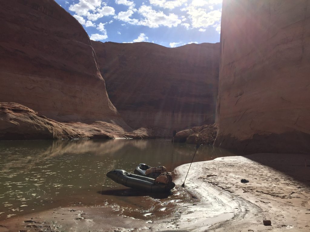
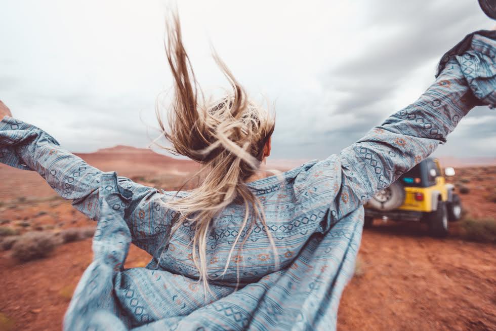
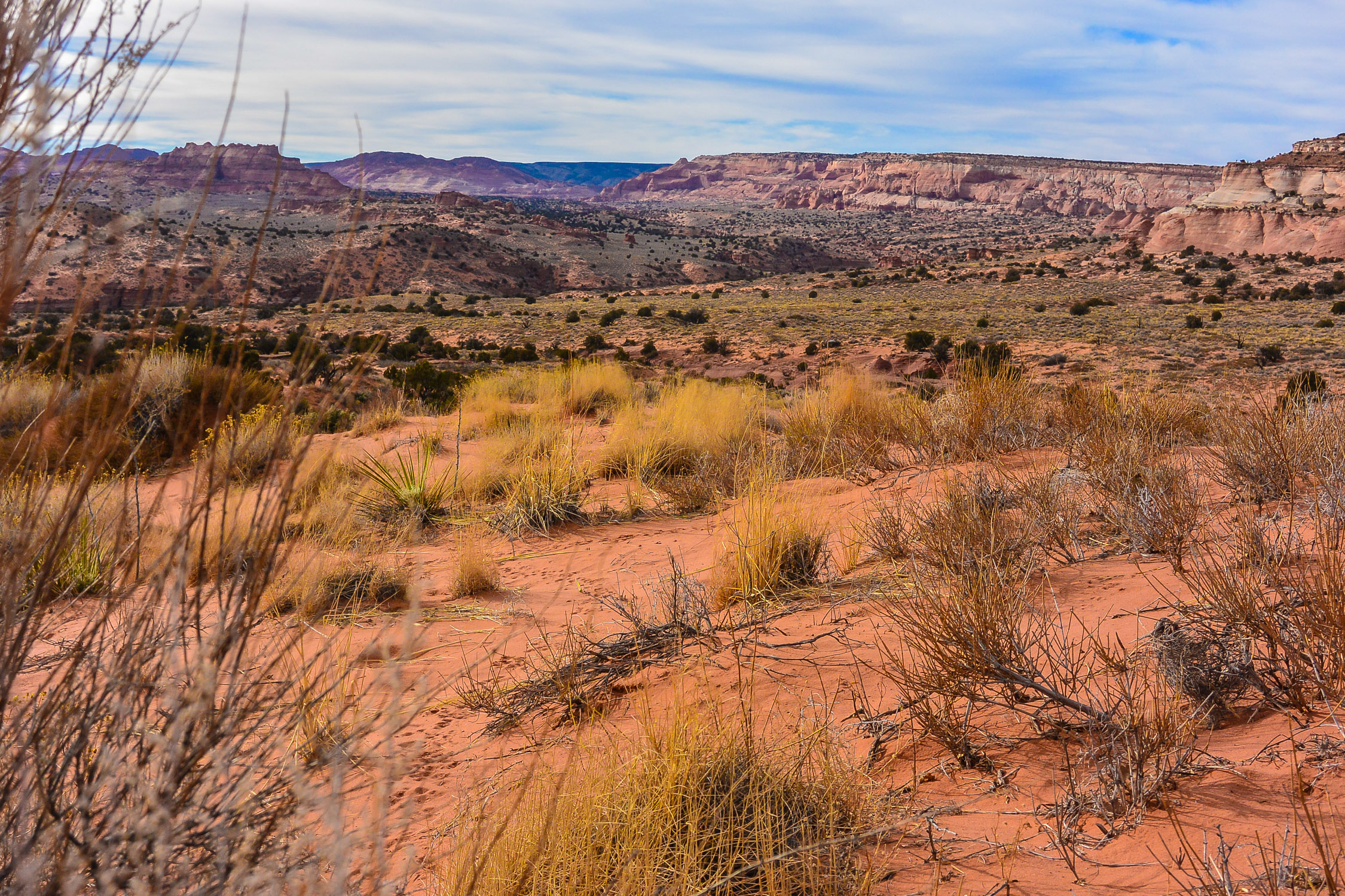
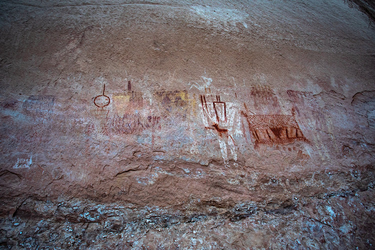
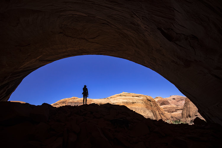
In May, Steve and I spotted a large cave in the distance. We decided to check it out, which required crossing in and out of a few shallow canyons as storm clouds drew nearer. When we arrived at the base of the alcove, a series of moki steps carved into the sandstone led up to the entrance. Steve led the climb and nimbly gained the ledge with his camera in hand, “Come on up Johnny!” As I gripped the shallow hand and toe trail, a gust of wind whipped my hair into my eyes, I shook my head to move the hair from my vision, taking in a most spectacular view of Navajo Mountain in the process. Once in the cave, I immediately spotted Clyde W drawn in charcoal on the dusty pink wall. The spot also contained an old fire pit, and I imagined this being one of Clyde’s secret camp spots. I wondered how many other obscure places Clyde wrote his name in over the years that were yet to be encountered.

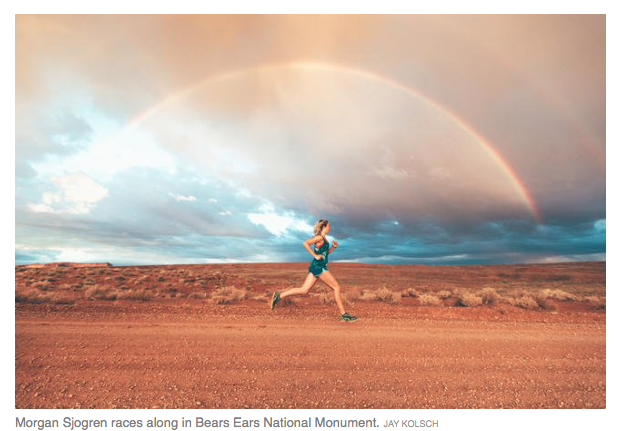
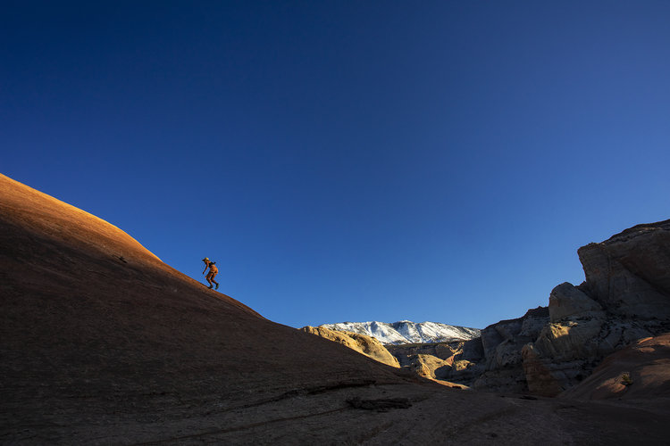
The next day, on an 18-mile run along the Rainbow Trail, Clyde’s name frequently jumped out at me as if to say “Hi” as I swiftly moved up and over the bald rock domes of sandstone. The minute details even more striking amidst competing views of the greater Grand Staircase and Glen Canyon drainages. Often his name accompanied others that I now recognize as Paiute, like Joseph Lehi, bold drawings of horses and portraits of Paiute men. Despite keeping an honest pace over the hilly terrain, I seemed to be setting a personal record for seeing rock art, as I took note of far more inscriptions than when I walked this same route much slower. I reminded myself to email my friend David Roberts about this later, as we have a playful ongoing debate about the best pace for spotting rock art. While David thinks it’s bullshit that I see more rock art when I’m running than walking, I credit the heightened awareness and tunnel vision that comes with the runner’s high for this enhancement.

Running along the Paiute Strip. Photo by Stephen Eginoire

Ironically, David also planted a seed of inquisition when I read a story he wrote (fittingly) about Mystery Canyon in his book In Search of the Old Ones, “I was beguiled by a defiant 1986 inscription I found along the Rainbow Bridge Trail: CLYDE WHISKERS PAIUTE INDIAN.” (p. 200) When I asked David if he knew anything about Clyde Whiskers, he confirmed that he was a San Juan Paiute and potentially that he was a relative of Paiute leader Angel Whiskers, perhaps linking him to an AW inscription that David found in Mystery Canyon. Here running on the Rainbow Trail, these Clyde Whiskers inscriptions motivate me to run just a little farther, over one more hill and around another bend in the canyon where, perhaps, I’ll find one more clue.

The San Juan Paiute’s presence is marked along the route to Rainbow Bridge and around Navajo (Paiute) Mountain. In 1909, Professor Bryon Cummings, W.B. Douglass and John Wetherill enlisted San Juan Paiute guides Nasja Begay and Jim Mike to help them become the first non-natives to document visiting Rainbow Bridge. The San Juan Paiutes successfully led the party to the stone rainbow, followed by a friendly controversy over which white guy spotted the bridge first. Today, Nasja Canyon is named in honor of Begay in addition to plaques honoring him and Jim Mike placed at Rainbow Bridge. Despite that recognition, homages to the San Juan Paiutes are few here, unless you factor in Clyde Whiskers and the accompanying San Juan Paiute names and artwork.

Seeking a high viewpoint near the route to Rainbow Bridge. Photo by Stephen Eginoire

 As I wander around the desert, Clyde Whiskers’ name continues to pop up.  My heightened curiosity bordering on madness, I scan the walls where Clyde Whiskers, like the Cheshire Cat, continues to elude me. Despite the seeming impossibility of ever knowing who Clyde Whiskers was, let alone meeting him, stopping now feels like giving up before pushing a slot canyon to its end. And yet, I contemplate whether I already know too much. It’s these types of mysteries that are at the core of what I love about the Colorado Plateau, the kind of place where you can explore forever without encountering all of its secrets or unearthing its hidden stories. Like the elusive landscape, we may never understand the petroglyphs, why people leave their names on walls, what type of drugs my dog took, the namesake of an obscure canyon or whether the man in the forest was a dream or reality.

For the sake of complete reporting and investigation, I  forge on and dig up a contact phone number for the San Juan Southern Paiute Tribal Council. I want to talk to a member of the tribe who knew Clyde, perhaps a link to one more detail, a link to understanding why this man felt so compelled to leave his mark across the desert. I dial and an operator picks up.

“Hi, my name is Morgan Sjogren, and I am working on a story about one of the former members of your tribal council. I’m wondering if you can help me locate any records or connect me with anyone who possibly knew him.” I am relieved that my unusual inquiry comes out intelligibly.

“Hmmm, well, that’s not really my job. Who are you looking for? Maybe I can help you.” The San Juan Paiutes are a small tribe, this shot in the dark could be as good as any.

“Clyde Whiskers.”

The woman immediately snickers, “Oh Clyde. Yeah, he’s still around.”

“Wait, like you mean he’s still alive?” She confirms, and I thank her profusely. Imagine her confusion in hearing my excitement that some guy she sees around town all the time is alive.

I put down my phone and grab my running shoes. It’s time to head back out into the desert to try to find Clyde. Perhaps he is lurking in an alcove waiting to find me. Back in my Jeep on the highway across the Rez, the warm air whips my hair into my face, as I take in views of my favorite landscape features – Comb Ridge, Bears Ears, Monument Valley, Agathla. On a whim, I stop in Tuba City, pull out my notepad and scribble a message and my phone number and leave it with the woman I called earlier. I am hopeful that an old-fashioned note will travel faster than a text message out here where cell service rarely exists. I reassure myself that now I have done everything I possibly can to track down Clyde, that I can in good conscious move on from this mystery. 

Less than an hour later, with the Painted Desert in my rear view, my phone rings. I answer without looking at the number, “Hello Morgan? THIS IS CLYDE WHISKERS.” Is this a dream? I immediately pull over – when the canyons call, you listen. His voice is strong and clear, and he is eager to talk to me. We agree to meet at McDonald’s the following weekend. I enter Clyde Whiskers into my phone contacts and hope that this isn’t another dead end. But it can’t be – Clyde Whiskers found me! Clyde proceeds to call me every single day and then hourly on Saturday, to confirm that I am actually still meeting him. The check-ins feel familiar, like seeing his name pop up on my long hikes and runs. I assure Clyde I would not miss this meeting for anything.

Clyde Whiskers in Tuba City, AZ, August 31, 2019. Photo by Stephen Eginoire

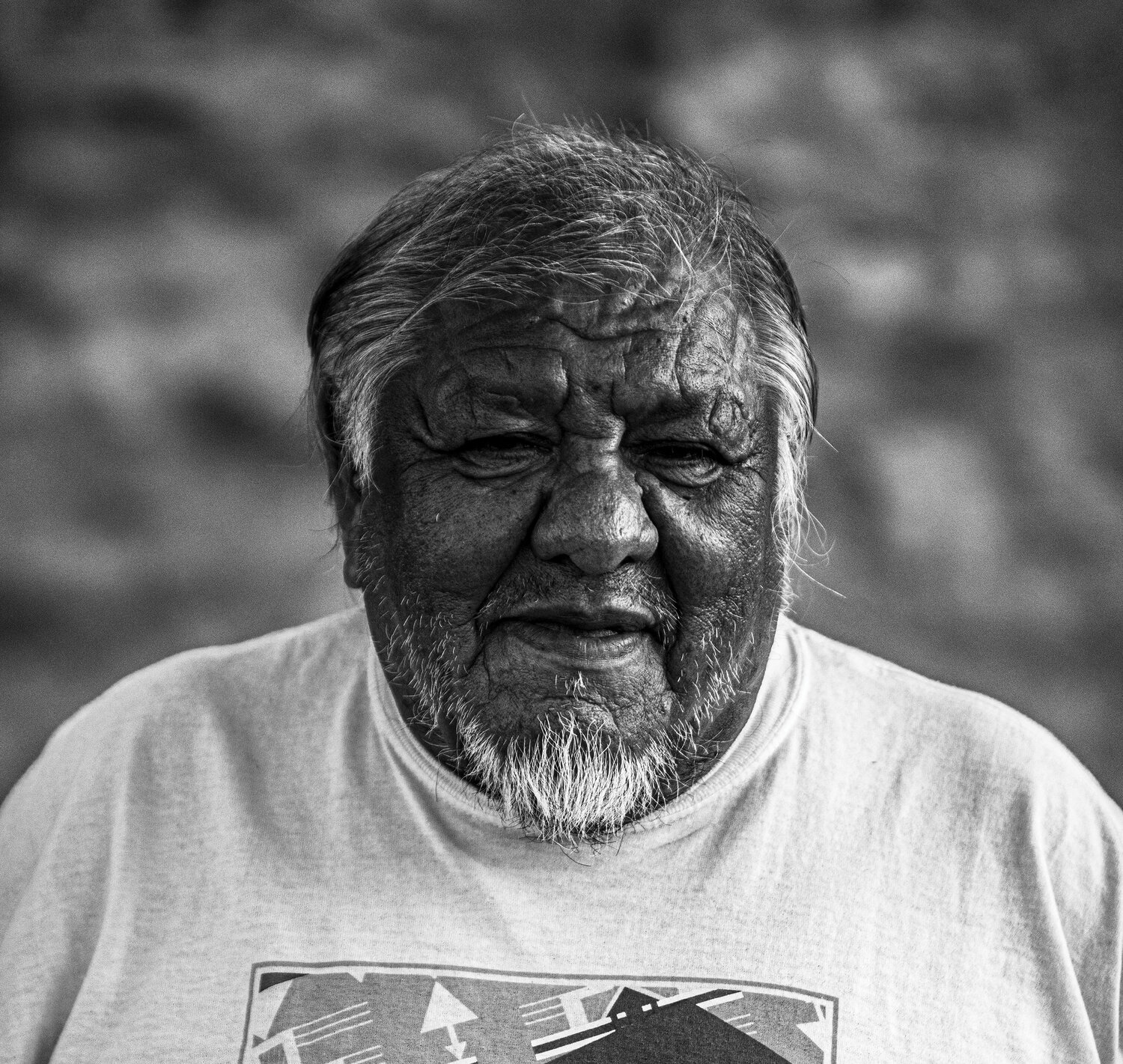
On a hot Saturday afternoon, I walk into McDonald’s but don’t see any men over 16 years old. I call Clyde again and walk back out the front door where a short stout man with white hair and whiskers answers his phone, “Hello Morgan!” He looks up at me with a big grin as I say, “Hi Clyde!” into my phone. We both laugh as we hang up our phones. I am in complete awe – in some ways this man has joined me on more recent adventures in the desert than anyone else.  We both are reserved with our conversation and decide to head across the street to the Hogan Restaurant where we can sit down for a proper meal and talk.

Once we are at the table, Clyde is direct, “So how did you find me?” I explain the long saga, including nicknaming a dog after him, to which he intermittently interrupts, “Yeah, I been everywhere.” He immediately shares a flurry of places where he signed his name, including some spots high off the ground during his brief stint at rock climbing, “But it was too dangerous, you know.” Despite having a head full of questions, I am simply interested in getting to know Clyde, the once-elusive canyon scribe, and receiving the stories he is willing to share with me. His explanation for his inscriptions at first seemed simplistic, “It’s what I did. I wrote my name everywhere.” But in between bites of his Salisbury steak, the layers leak out. “Yeah, my uncle Angel Whiskers taught me to write my name, you know.” Later in his life, on a Grand Canyon river trip with other San Juan Southern Paiutes, Clyde first learned about the modern consequences of carving your name on public lands and has since acted accordingly, “We don’t do that anymore. It’s what we used to do, not anymore.”

His stories about his name inscriptions blend into what happened to the San Juan Southern Paiutes and specifically, “The Navajo keep erasing our names out there. Navajo Mountain used to be Paiute Mountain, you know.” He talks about his parents losing their land to the Navajo, reminisces about his youth grazing sheep on the flanks of Navajo Mountain and recalls the horror when he first saw the waters of Lake Powell flooding the surrounding tributaries of his home near Glen Canyon. Amidst these attempts of newcomers to rename and reshape the land that the San Juan Southern Paiutes called home, Clyde wrote his name. Eventually Clyde took to more formal writing, spending 10 years helping compile the San Juan Southern Paiute Tribal Constitution. While he is no longer a member of the Tribal Council, he remains engaged with tribal politics and is eager for the day when the San Juan Paiutes have tribal land of their own again.

“They don’t put Paiutes in books like they do Navajo, you know.” Clyde reaches into a plastic sack he carried along and pulls out some papers. “One time there were other guys out at Paiute Mountain writing stories too. They wrote about us. I never met them even though I was out there. Maybe you know them?” He hands the paper across the table and my heart leaps–it’s a photocopy of David Robert’s Mystery Canyon story from In Search of the Old Ones. “Clyde, I know David!” He puts down his fork and smiles, “Then you can tell him AW is my Uncle, Angel Whiskers.” One of the final conundrums of Mystery Canyon resolved by the mystery man himself.

I reach into my belongings with an offering of my own, “Clyde, they didn’t leave the Paiutes out of this book.” It’s Logan’s book about Southern Paiutes. I open the pages to show Clyde where members of his tribe also mention him in their stories. “Yeah, I knew her, Bessie. And that’s Jack, and Mary Ann. And I remember Logan, too.”

His pride for his heritage is unflagging, and at one point he pulls out his wallet to show me his official San Juan Southern Paiute Tribal Card, which he only recently received despite the tribe’s official recognition in 1989. As he thumbs through his wallet, his driver’s license catches my eye: Clyde Kluckhohn Whiskers. It’s a fantastic detail as Clyde Kluckhohn was a young adventurer who explored the Southwest by horseback on a dirtbag budget in the ’20s and ’30s. He went on to write two books about his explorations, (To the Foot of the Rainbow and Beyond the Rainbow). Additionally, his encounters with tribes along the route, including Paiutes in Navajo Mountain, inspired him to pursue a career in Southwestern anthropology. “Clyde, you were named after Clyde Kluckhohn the adventurer?” With his trademark pride, he confirms although he doesn’t know if his parents ever met the other Clyde. “He was famous, you know. In books.” I look into Clyde’s kind eyes, “You are, too, Clyde, you’re in a lot of stories now.” For a surreal moment, I feel the adventurous spirits of Clyde Kluckhohn and David Roberts joining me and Clyde Whiskers in Tuba City, eager to trade stories and tease one another with hints of new mystery spots.

  “This is like a dream. The dream is right here.” Clyde looks at me and I feel exactly the same way. He clutches the Southern Paiute book with his right arm, where “Clyde” is tattooed in script letters across it.

 What an indelible impression that this man’s name has left on me, and on this Earth. History is a mélange of the incomprehensible and questionable – impossibly layered by time like the geographical forces that shape the canyons and mountains; here the truth is always embedded, but often difficult to find. And perhaps this is why it is so human to etch our names, our handprints, our history with sharpened point or ink, on stone and skin. Like Clyde Whiskers and the San Juan Paiutes, we don’t necessarily need all the answers, we need to exist.

Morgan considers the Colorado Plateau territory her home, where she runs wild chasing stories and adventure. Her Four Corners-inspired writing is focused on public lands, human-powered adventure and exploration. She is the author of three books: The Best Bears Ears National Monument Hikes, Outlandish: Fuel Your Epic and The Best Grand Staircase National Monument Hikes (available in October).

During a camping trip to Yosemite with my Dad our food supplies started getting low. We couldn’t stomach another round of beef or chicken ramen powder. So I came up with my first-ever truly dirtbag solution. From our camp spot, I walked over to the Tuolumne Meadows general store café and hit the condiments table. With a few packs of soy sauce, peanut butter, and a cup filled with sriracha, I transformed our ramen noodles into a scrappy yet sumptuous version of pad Thai.

The meal was delicious, the sunset views stellar, but best of all is the fun memory with my Dad this meal always brings me back to. We had a few other hiccups on the Yosemite trip, and my Dad had a very zen perspective deep in the valley which has stuck with me ever since,

“Down here, we are getting a massive hug from the granite walls. The bottom is an amazing place. We are as low as we can be around these parts; it is rare to be here. Sometimes breaking down is the point. Now the only place left to go is up.”

Makes 2 noodle bowls

When food supplies were getting low and Dad and I could not stomach another round of chicken or beef ramen powder, I came up with my first-ever truly dirtbag solution. From our camp spot, I walked over to the Tuolumne Meadows general store café and hit the condiments table. With a few packs of soy sauce, peanut butter, and a cup filled with sriracha, I transformed our ramen noodles into a scrappy yet sumptuous version of pad Thai. These days, I pack in a baggy filled with coconut milk, which is worth its weight in flavor and extra calories.

Cooking tools:
Backpacking stove (1 or 2)
Backpacking pot (1 or 2)
Bowl or ziplock bag
Can opener
Knife

4 packs ramen noodles (or rice noodles)
1 spoonful coconut oil
2 cloves garlic, minced, or 1 tsp. garlic powder
½ cup peanut butter, crunchy or smooth
2–4 Tbsp. soy sauce
2–4 Tbsp. sriracha or other hot chili sauce, to tast

Optional ingredients
1 15-oz. can coconut milk
Protein (eggs, chicken, beef, canned salmon)
Veggies

If you have two backpacking stoves, start the noodles and the sauce simultaneously.

Boil the ramen noodles in a pot on your stove. When cooked, strain most of the water into a bowl. (Use the leftover water for cleanup or drink it before a run to get extra carbs!) Keeping a small amount of moisture in the ramen helps the peanut sauce coat the noodles evenly.

If you have only one stove and pot, set aside the noodles in a bowl or a ziplock bag while you make the sauce.

To make peanut sauce
Heat the coconut oil. Add garlic and sauté until slightly golden. Adjust heat to medium and stir in peanut butter. Gradually drizzle in the soy sauce as the peanut butter melts, tasting to see how salty and flavorful it is getting. (Depending on how much salt you are craving from your last mission, your preference may vary.) Repeat with the sriracha. I use roughly the same amount as the soy sauce, but make it your way.

Add coconut milk if you have it. Continue to stir until sauce is fully blended—but not too long or it will dry out and become clumpy.

Add sauce to noodles and mix until evenly coated.

If you have veggies or protein along, toss them in the pot with another spoonful of oil and cook to your liking.

Add the veggies and protein in with the noodles and sauce and serve with a side of sunset.

Outlandish by Morgan Sjogren, The Running Bum

To read more about the Yosemite adventure with my Dad check out Outlandish.

Who doesn’t love pesto? Who hates kale?

Vegetables are critical to our health, though they likely are taking a back seat to more shelf stable foods during tough times (or even camping trips).

This delicious spread is garlic with a bit of zing. I bet the pickier eaters won’t even notice that it’s really a vegetable in disguise. Using greens in sauces, spreads and soups is a great way to prevent spoiling and to spread them out between trips to the store. This pesto can be stored in the freezer or canned. 

Best of all, this pesto is loaded with immune boosting vitamins and ingredients. Kale is loaded with fiber, protein, thiamine, riboflavin, folate, iron, magnesium and phosphorus. It’s also a very good source of vitamin A, vitamin C, vitamin K, vitamin B6, calcium, potassium and manganese. Garlic is a known to help fight germs and boster your immune system thanks to a compound called allicin. Pumpkin Seeds are filled with iron (essential for healthy red blood cells). Lemon adds vitamin C to the mix which is great for immunity, but also helps you absorb the vitamins. Finally, olive oil also aids absorption, is an antioxidant and immune booster. It also gives you extra calories important in lean times. 

Ingredients:

1 small bunch kale

1/2 lemon

Handful raw pumpkin seeds

3 cloves raw garlic, crushed

1/4 cup olive oil

Salt and pepper to taste, about 1 teaspoon each

Combine all ingredients into a food processor or blender. If it gets “stuck” during blending adding more olive oil can help. Puree until smooth.

Serve on pasta, as a sandwich spread, mixed in eggs, on grilled meats, and just about everything!

Store in the fridge in an air tight container.

Screen Shot 2019-05-12 at 5.45.31 PM.png

The Path Of Light was originally published in The Gulch Magazine Issue 8. Subscribe to keep these stories alive!

John Wetherill near Rainbow Bridge in 1923. Courtesy of Harvey Leake.

John Wetherill near Rainbow Bridge in 1923. Courtesy of Harvey Leake.

Ch-ch-ch-ch-cha. The gears of my Jeep grind to a stop as I attempt to reverse out of my U-turn in the middle of the two-lane highway cutting across the backside of Navajo Mountain. It’s as if Sunny (the name of my stubborn old yellow mare) knew we were near the end of the paved road where her services were no longer re­quired. Using fourth gear, the only one still working, I limp the old gal off the side of the road and tie her up next to an old metal water tank, “Bull Shit” streaked in red graffiti across it. I grab my pack and continue on without her, as is becoming far too customary on my desert expeditions.

A storm blew my Jeep north to canyon country over a month ago, when I began following a muddy road retrac­ing the footsteps and stories of one of the Southwest’s most notable, misunderstood and elusive explorers – John Wetherill. John’s work spanned ranching in Mancos, own­ing a trading post in Kayenta and guiding the rich and fa­mous in the desert. However, he is best known for his major contributions to U.S. archaeology, along with his brothers in the Wetherill clan, who differentiated the Basketmaker people from the Puebloans based on skull shapes, in addi­tion to locating sites like Cliff Palace and Keet Seel. John is specifically written into the history books as the first white man to step foot under Rainbow Bridge. Despite his national renown and lifetime of accomplishments, John was a quiet guy who kept thin records, less than 15 pages scribbled in pencil, of his explorations (Blackburn, Fred. The Wetherills, 2006. P. 128-131). Unlike his more outspo­ken brother Richard, whom he out-lived by 30 years, John shunned spotlights on his accomplishments and often handed off the credit of his discoveries to the tourists he guided (Blackburn, p. 111).

The silence created additional space for trolls to fill in the blanks, accusing John and his brothers of unethical excavation practices like using dynamite in cultural sites and plundering artifacts for profit. All disproved in time, his fine work and revered reputation among natives and academics spoke volumes. Nary an explorer of the region, past or present, would deny being inspired by “Hosteen John” (a nickname respectfully given to him while living amongst the Navajo in Kayenta). Until the very end of his life in 1944, most adventurous souls (including Teddy Roo­sevelt) heading into the heart of what still remained a mys­terious blank on modern maps, chose to hire him as their trusted guide.

John Wetherill in Glen Canyon. Courtesy of Harvey Leake

John Wetherill in Glen Canyon. Courtesy of Harvey Leake

Rainbow Bridge in 1909. Courtesy of Harvey Leake

Rainbow Bridge in 1909. Courtesy of Harvey Leake

What little we know about John has been relayed through the reports of the men he guided and Wetherill family history, much of it passionately compiled by his great grandson Harvey Leake who is devoted to this doc­umentation in addition to his day job as an electrician. My quixotic mission to “explore with John” began by meet­ing with Harvey in mid-February at the South Rim of the Grand Canyon. Disheveled and frazzled, my tan brimmed hat hiding my desert rat’s nest of bed head, I parked the Jeep and ran through the snow into the Shrine of the An­cients to make our 9 a.m. appointment. Harvey, already out-front waiting, greeted me eagerly while insisting we go inside to find a quiet corner to talk. As we took our seats, Harvey cannot hold back, “You got John all wrong!” It’s a direct criticism of my characterization of John in, “Explor­ers Wanted” (my last story for The Gulch, Issue 7). The ad­monishment is paired with an exuberant smile and a spark in his eyes – the kind that wells up when you are about to share something special, like a grandparent bestowing a birthday gift to a young child.

Ears wide open, I scribbled furious notes as Harvey set the record straight about John’s pedigree as a pioneering archaeologist and first-class human being. Stories about John could fill countless adventure novels and Western films, and perhaps that’s why his personal records are slim. The man seemingly used every precious second of his life tracing the lore of desert mysteries, while helping others curious spirits do the same. In terrain that at the time was still not completely mapped and is still in times of modern navigation tools seriously mysterious and seldom seen, John covered an unfathomable portion of it.


John Wetherill napping at Rainbow Bridge in 1909. Courtesy of Harvey Leake

John Wetherill napping at Rainbow Bridge in 1909. Courtesy of Harvey Leake

“When you get to a fork in the trail, will you choose the path of progress or the path of light?” -Harvey Leake

From here Harvey’s tone took an abrupt turn and he looked directly into my eyes, “When you get to a fork in the trail, will you choose the path of progress or the path of light?” he asked. Not exactly the dry history lesson I came here for. He explained this question is a tenant of the Wetherill family passed down to Harvey via their Quak­er roots and life amongst the Navajo. The Quakers believe that human actions are directed by personal responsi­bility (“inner light”) as opposed to being puppeteered by God. The Navajo similarly believe in the personal choice to select positive thoughts and actions to impact the lives of not just themselves but the collective, as explained by Wolfkiller to John’s wife, Louisa, who translated many of his stories from Diné to English. Outliers in mostly Mormon Mancos, the Wetherill’s faith rooted in spiritual equality ultimately made them feel more at home amongst the Navajo, prompting their move. Reminding me that this was not a rhetorical question, Harvey asked me once again which path I would choose, to which I responded, “The path of light.”

Harvey smiled, and we proceeded to pull out maps, in­cluding a topo from 1953, to dissect an expedition route I planned to retrace. Two hours later, we’d hardly scratched the surface when Harvey needed to hit the road. Waving as we drove our separate ways, I rolled up a burrito and headed to the South Kaibab Trail. Looking down into the snow-frosted layers of geological time, I contemplated my next move in between bites of beans. Despite fully knowing that the tremendous recent snowfall would make canyon wandering impossible, I returned to the Jeep and pointed north on the highway. The “path of light” leading me to Cedar Mesa.

I kick my running shoes together, shaking off some of the red Utah mud they’ve become caked in as I’ve spent over a month of the Colorado Plateau’s wettest winter on record living outside in the same canyons that John also called home. During long dark nights, temperatures dipped into the single digits, I devoured accounts of John’s “dis­coveries” and adventures as told by his exploring contem­poraries T. Mitchell Prudden, Neil Judd, Jesse Nusbaum, Ansel Hall and Charles Bernheimer. Burning the midnight oil (of my headlamp) I read that, “Nearly all the brothers’ archaeological excursions took place in winter, the only season they could spare from ranch work. The sheer lo­gistics of Wetherill’s toil in Grand Gulch – up before dawn, working long into the night, camping in snowstorms, pack­ing artifacts by horseback over 100 miles back to Mancos – testify to his diligence.” (Roberts, David. In Search of the Old Ones, p. 36) In these words I found comradeship for my efforts to stay warm at night wrapped in thrift store fur coats and down blankets, full days navigating new winter approaches into already sinuous canyons, and the reward of experiencing the details of this place in a way that few will ever know.

It’s far from an ideal time of year to be in Grand Gulch and surrounding canyons, the same area where John dis­covered the infamous Cave 7 burial site. And yet, stomp­ing around in thigh-deep snow will remain some of my fondest passages through this landscape. Buried boulders made every step precipitous as I used a downed juniper branch to scout for ankle breakers and self-arrest on the ice-glazed slickrock. Low sunlight and the contrast of the white foreground brought new life to rock art as faded red handprints and etchings of spread eagles wings lurched from the rock to touch me. Cliff dwellings, woven into the pockets and folds of the landscape, now demurely peeked out from behind towering curtains of ice suspended from caves in mid-air. The surrounding sandstone walls were bedazzled by gleaming chandeliers of frozen hanging gar­dens.

It felt as though the snow and ice would cling to Ce­dar Mesa indefinitely – further freezing its portal into the past. A rare intimacy and stillness overtook me as I slowly moved through it. “The snow will be with us for several moons now, and if you roll in it and treat it as your friend, it will not seem nearly as cold to you.” (Wolfkiller, as translated by Louisa Wetherill, p.64) I clung to this guid­ance as I deepened my friendship with winter, the daily freeze-thaw cycle entertained me immensely, and the sea­son momentarily felt eternal. And yet, the sound of drip­ping, then flowing, and eventually rushing water told oth­erwise as the sun rapidly melted the canyon Valhalla into a muddy oasis.

Even the heaviest winters are ephemeral in the desert. Today, the sun warms my back as I leave the broken-down Jeep behind and follow the dusty, dirt rez road to its true end, the place where the Rainbow Trail, blazed first by John, begins. Though there is a well-maintained trail laid out in front of me, I take a moment to comprehend what traversing this landscape sans maps or marked route felt like for John. I look over the unending expanse of slick­rock domes, hidden canyons, river confluences, and un­touchable mesas all butted up against the ribcage of Navajo Mountain, the heart of this landscape. At 10,300 feet, it is still covered in snow, and the occasional icy breeze blows down, making the contrasts of this region, the past and present, the known and unknown, all the more enticing.

Exploring the expanse of slick rock domes near the Rainbow Trail. Photo by Stephen Eginoire

Exploring the expanse of slick rock domes near the Rainbow Trail. Photo by Stephen Eginoire


Along this convoluted road from Bears Ears to the Rain­bow Trail, I’ve serendipitously crossed paths with prolific writer David Roberts, whose award-winning work spans from mountaineering to the Colorado Plateau (his true love). He and his wife Sharon were visiting from Boston and graciously welcomed me to stay with them in Bluff as we spent several days trading stories and driving around Cedar Mesa. Mornings began with dark steaming cups of coffee as we both furiously edited our upcoming books. One afternoon drive around Cedar Mesa prompted continuous storytelling and beta exchanges – the passion for place buzzing louder than any song on the radio ever could. We stopped at the ghastly gash in Comb Ridge, where Highway 95 bisects it, and stared up at its grandeur. Despite both of us having traversed the ridge, (documented in David’s Sandstone Spine, which guided my own crossing last fall), we continued to dissect the ways we would do it if given another opportunity to explore an 80-mile-long swath of stone. Nights wound down with cold beer as we rotated be­tween reading local history juxtaposed with each other’s stories. Before his departure back home to Boston, David connected me with researcher and John Wetherill chaser Fred Blackburn, along with a slew of tips and reading ma­terials to keep my momentum humming.

I met up with Fred in Cortez over a greasy diner break­fast. He held back no profanities as his storytelling dove abruptly between Wetherill history and his own work as a BLM ranger, which he described as his “Vietnam” and “do­ing his time.” It is imperative to note that Fred’s extensive “reverse archaeology” helped document much of John’s discoveries and pinpoint their “lost” locations, most nota­bly Cave 7. Our conception of John today is as much owed to Fred (and Harvey who has teamed up with him as an ally) and his tireless efforts to locate John’s poorly docu­mented work. Plates cleaned, we moved our party (meeting is much too stiff a word after five cups of coffee, five strips of bacon and the expletives being launched between us), to Fred’s office. Digging through his extensive archives, we ultimately blew off discussion of John completely, shifting to the future of Bears Ears, a place Fred says he won’t re­turn to, like many proclaim about Glen Canyon, now looted and maintained beyond his nostalgic recognition. We did manage to pull out the maps, and Fred excitedly drew his favorite route to Rainbow Bridge upon it, complete with notes for tracking water and rock art. So enraptured in our banter, Fred lost track of time and had to bolt for another appointment. He encouraged me to stay behind, and I lin­gered just long enough to peruse the photos on the wall and his historic book collection.

Despite having extensive information about John Wetherill directly from primary experts, my head spins, unable to process it all. I can’t yet put my finger on what could possibly be the missing piece. Rather than a clear picture of John, these encounters gifted me a treasure trove of maps, beta, clues, stories, laughter and genuine friendship only understood among the obsessed, or per­haps possessed, explorers of the Colorado Plateau. And above all, an even greater itch to get out and explore. Da­vid and Fred, and Harvey, are my Scarecrow, Tin Man and Cowardly Lion, walking arm in arm down the path lit up in late-afternoon sunlight on the Rainbow Trail.

Painted wall. Photo by Stephen Eginoire

Painted wall. Photo by Stephen Eginoire


On this hike I am (actually) joined by Steve Eginoire, The Gulch founder and editor, and his trusty desert husky, Phil. For “research purposes,” we unanimously renounce our previous identities and time travel via a 1920 Expedi­tion to Rainbow Bridge. Leading the charge with my tan cowboy hat and bolo tie, I’m Johnny (Wetherill), the des­ert-dwelling explorer forging a life in the canyons. Steve channels Charles Bernheimer (along with a German ac­cent), the self-proclaimed “tenderfoot cliff dweller from Manhattan.” Bernheimer, a wealthy East Coast business man, used portions of his fortune to fund annual South­west expeditions over 15 years, hiring John on each of his missions (Bernheimer, Charles L., p. 6). Scampering alongside the mule train is Clyde Whiskers (Phil), a San Juan Paiute whose name is etched on so many of the can­yon walls circa 1969 and 1975. It’s not exactly historically accurate, but we enjoy calling out to Sir Whiskers as he waddles down the trail wearing his doggy backpack.

In all, we spend four nights and five days to complete our round-trip outing to Rainbow Bridge and its surround­ing canyons – overkill in terms of time needed to cover the distance, but not nearly enough time to absorb the expe­rience. We are equipped with several maps and a slew of sightseeing recommendations from Harvey, Fred and Da­vid. Like a weathered cowboy, I am quick to roll out of bed each morning as the sunlight emerges over the high canyon walls and warms my face. I boil water for coffee as I simul­taneously pack up my bedroll. Bernheimer takes care to meticulously lay out, reorganize and repack his gear each morning – a process that he has no doubt gleaned from climbing, where every piece of gear must be accounted for as if your life depends on it (because it does). I tease him about this as I read an article by Harvey that exposes Bern­heimer’s quirky city dweller habits on expeditions – dress­ing up in fancy riding pants, refusing to drink anything but boiled water and all but tolerating the simple camp food. Berny is a good sport and volleys back, “Are you in a hurry to get somewhere Johnny?”

A huge alcove shelters a large Basketmaker II site. Photo by Stephen Eginoire

A huge alcove shelters a large Basketmaker II site. Photo by Stephen Eginoire

Despite the stunning posture of Rainbow Bridge (the largest natural bridge in the world) being the turnaround point, our hiking is not directed by distance or destination, and we are equally eager for the return trip. The canyon’s clues guide us along the path of explorers past. We are mesmerized by the details tucked into the jumbled tex­tures of this fractured and faulted world of stone. A mas­sive alcove sheltering a Basketmaker II site overwhelms us, Slickrock ramps and ancient hand carved moqui steps inspire scrambling. Inscriptions on the canyon walls draw us further into their stories. Gleaming pools of clear wa­ter stop our momentum, but further our experience, as we stop to swim and splash. Later we bake like lizards on the silky, skin-toned sand as oak trees leaf in bursts of green before our very eyes. We race dusk to the next pass and are rewarded to a double-edged sunset overlooking two distinct valleys as their horizons stretch our imaginations. Our evening camps increase in scenic beauty each night, and we indulge in the simple luxury of a campfire, boiled mashed potatoes with bacon, and bedtime stories read aloud from David’s In Search of the Old Ones.

On our final day, as we climb back up and over the passes between canyons, my eyes can hardly comprehend the far-reaching mystery and beauty stretching before us. I’ve pushed the pace for most of the trip but now find myself trailing, stalling, slowing down – no doubt searching for a way to linger here, if not outright stay. A chill down my spine and tears in my eyes signal a deep and instantaneous connection that I’ve only encountered in precious few landscapes. I’ve come to recognize that it’s more than a feeling but rather an intercellular knowing, perhaps better described as the inner light, that I am incapable of ignoring.

Somewhere over the Rainbow. Photo by Stephen Eginoire

Somewhere over the Rainbow. Photo by Stephen Eginoire

At the base of Naatsis’áán (Navajo Mountain), with the Bears Ears behind me and Grand Staircase-Escalante in the distance, I stand at the heart of the places I’ve lived for two years. Dwelling out in the wild and within the landscape – tucked deep in canyons, sheltered in caves, bivvyed on mountains, snuggled with wildlife, laid completely bare across spines of slickrock – I feel at home in the boundless outer space. The cliff dwellings and inscriptions have never baffled me, they serve as beacons of hope that, like those who walked here before me, I can live here too. The migrations and exodus of the ancient ones ultimately remain a mystery, as does how I found myself, a California girl, so suddenly and deeply immersed in this place. Some questions are not meant to be answered, they are prompts for exploration. Here I feel a deeper connection with the rocks, the waterways, the wildlife and the past than I have in the countless towns I’ve temporarily called my home. Living in the desert lends itself to my restless nature – the words nomad, wanderer and explorer are etched onto the walls of my DNA.

I recognize fully that I am a visitor here, that this land and its roots are not my own – but what is? So often I’m asked where I’m from, and the answer has evolved from everywhere to nowhere, but these days I find myself saying, “right here.” Home is the dirt beneath my feet. Human boundaries cut, confine, contain. Earth expands, uplifts, reveals. Like everyone else, I’m merely passing through.

Inscription in a remote remote canyon below the Rainbow Trail. Photo by Stephen Eginoire

Inscription in a remote remote canyon below the Rainbow Trail. Photo by Stephen Eginoire

Who was John Wetherill? My exploration for John did not guide me to an obscure journal or a definitive answer. Black and white photos, quotes and oral history only provide hints. As I walk in the footsteps of his explorations, and even sit beneath his name written across the water-varnished red canyon wall beneath Navajo Mountain, I realize that to know John is more about getting to know this place, to which he devoted his life and made his home. Though his writings are few, what he managed to scrawl with his weathered hands characterizes him best, “The desert will take care of you. At first, it’s all big and beautiful, but you’re afraid of it. Then you begin to see it’s dangers and you begin to hate it. Then you learn how to overcome its dangers. And the desert is home.” (Hosteen John)

Yes John, the desert, there’s no place like it. I arrive back at my Jeep more thankful than ever that it will not start – at last, a way to stay.

Rainbow Bridge. Photo by Stephen Eginoire

Rainbow Bridge. Photo by Stephen Eginoire


Morgan runs wild with words and lives outside on the Colorado Plateau. Her Four Corners-inspired writing is focused on public lands, human-powered adventure and exploration, (including her first book The Best Bears Ears National Monument Hikes). Her next books, Outlandish: Fuel Your Epic and The Best Grand Staircase National Monument Hikes unleash into the wild this spring and summer.

This story is published in issue 7 of The Gulch. Subscribe here.

P056LS2012_023_038.jpg


Like a lone desert tower, I sit on the red dirt, eyeing a storm over Navajo Mountain. It’s January, a cold and dark time to be out camping, even in the desert, but I cannot resist any opportunity for quixotic exploration across the Colorado Plateau. Be it canyons, history or artifacts, this is a place layered in secrets, steeped in mystery and covered in controversy.

During my explorations in the Southwest, my mind often bushwhacks through time. To a time long before Glen Canyon was dammed, before white men put this region on a map, and before humans stepped foot where dinosaurs roamed. My imaginary time travel has taken me down narrow slot canyons with Everett Reuss, on bumpy covered wagon rides down Hole in the Rock road, and to corn storage hubs in ancient Puebloan hideouts. Despite the perception that the golden age of discovery is long over here, the shifting layers of sand, strata and politics still draw a certain breed of mad ones, fools and wanderers as the landscape calls out over the faint zephyr winds, “Explorers wanted.”

So, on this trip back in time, I join Ansel Hall, perhaps best known and revered for his role as the National Park Service’s first chief naturalist between 1923-30. His efforts within the park system are punctuated by founding the first park museums and other educational endeavors, including self-publishing his own visitor guidebooks when the government would not produce them to his standards. A California native (like myself), Hall was entranced with exploring the Sierra Nevada, starting out as a ranger in Sequoia National Park and working his way up the Park Service hierarchy always with a focus on education.

In Kayenta, Ariz., circa 1932, alongside prominent local explorer John Wetherill, Hall became increasingly entranced by the area’s densely pocketed nooks, slithering canyons and vision-gripping mountains. “One cannot be long in the southwest without crossing the trail of John Wetherill,” Hall explains in his first “Help Wanted” ad, hoping to recruit 10 willing explorers (1933). “In the (eighteen) eighties he discovered Cliff Palace and many of the spectacular ruins of the Mesa Verde. Rainbow Bridge, Betatakin, Keet Seel, Inscription House and dozens of other names have been added to the map through his inquisitive and energetic quest for what lies on the other side of the mountain.”

To some, Wetherill was often considered less than savory in his exploratory and excavation methods. In the academic and conservations worlds, his process was a little more “cowboy” than other professionals in his field:

“‘Look at this!’ (Wetherill) walked over to the corner of the long low room and dragged out an enormous three-foot bone that he had found the week before, with the remark that he, ‘guessed the rest of the beast is still mostly underground.’” (Hall, A. California Monthly, Vol. 30 “Explorers Wanted,” 1933). Despite his lack of formal training, there is no denying his pivotal contributions to archaeology in the Four Corners.


P056LS2012_023_028.jpg
P056LS2012_023_015.jpg

 Hall’s own appetite for adventure extended beyond his home turf, and his extensive collection of diaries detail wanderings through Madrid and Paris where he took in local gastronomy, became enamored with waitresses and toured museums. I imagine Hall and Wetherill out in the canyons on an idyllic fall afternoon trading stories. As Hall brings up his Central American travel exploits, Wetherill, true to salty local style, is not impressed, “Why go to foreign countries? There’s plenty of exploring to be done right down in this country; and as for scientific work – well, it’s hardly been touched.” (Hall, A. California Monthly, Vol. 30 “Explorers Wanted,” 1933). Hall, like so many who arrived in the Southwest before (and after him) must have been swept away in this prophetic statement while taking in the statuesque views of the Four Corners region, leading to the deepest rabbit hole of all –conservation. The duo put their crafty minds together, dreaming up an expedition with an end goal of a new national park.

The area in Hall and Wetherill’s discussion was roughly 700 square miles between the Colorado and San Juan rivers on Navajo tribal Land. Their proposed national park is quite literally filled in with red crayon on an original USGS map and encompasses a vast amount of landmark terrain, features and cultural sites. To launch the park proposal, Hall organized the Rainbow Bridge Monument Valley Expedition in 1933. A Depression-era project, on paper the expedition was something that should not be, and yet flourished in spite of the economic draught.

P056LS2012_023_020.jpg

The RBMV Expedition shifted from a one-season project to a behemoth production over the span of five years (1933-38) and is considered one of the last “great” expeditions of this scale. The primary objectives were ambitious: produce accurate topographical maps of the area; contribute significant discoveries to the fields of biology, geology, paleontology and archaeology;  and advance education, outdoor experience and protection for the area.

Hall was known to many as a shrewd businessman and romantic idealist but orchestrated the impossible to fund this mission. With minimal federal dollars, he pulled together corporate sponsors like Ford, Gilbuck Boats and Leica Cameras to donate funds, vehicles and equipment in exchange for photographs, stories and film from the expedition to be used in ads. The expedition’s 1938 estimated operating expense report tallies the costs at $6,000 for travel, commissary, motor, pack, haul, science, equipment, buildings, contingencies and misc., and 43 men. With inflation, that is over $105,000 today.

Hall’s “Help Wanted” ads targeted young lads with disposable income, projecting an opportunity for wild west excitement and the summer adventure of a lifetime, for $275. His charismatic recruitment rallied more than 250 applicants over the course of five years.  “Does it seem strange to ask a man to pay for the privilege of working hard, living entirely out of touch with civilization for a couple of months, and possibly even enduring some measure of physical hardships?” (Hall, A., “Explorers Wanted.”)


P056LS2012_023_030.jpg

 Expedition artists sat on canyon ledges to paint romantic scenes of Rainbow Bridge, as aerial photographers soared in planes overhead capturing stunning panoramic photographs of the indescribably unique landscape. On the ground, teams of strong, hearty guys hauled excavation gear by pack mule to remote locations in scorching heat. With no trails to follow, and sand storms and cloud bursts mentioned in nearly every journal entry, the expedition members were privy to an experience precious few were privy too – summer monsoon season OUT in the desert. They dealt with unbearable waves of heat slashed by torrents of rushing water, sometimes from storms as far as 50 miles away and indiscriminate lightning strikes in the exposed terrain. Perhaps no other season and no other place can remind humans that we are just animals at the mercy of the land. Water and food were necessarily rationed, yet photos show crew members crawling happily exhausted out of their tents in the early morning for that first cup of coffee, sun peeking over the canyon rim.

Maps used during the expedition show swaths of roadless land, requiring Hall’s assemblage of Ford vehicles to overland through sand dunes, washes and the same clay that almost stuck my Jeep this morning. Old expedition photos of men pushing the Fords in the most motley of places does not hint at hardship. In nearly every photograph, those toiling in the exposed sunlight, descending perilous cliff bands, toppling over rapids in small boats, are smiling.

Right now the spirit of adventure runs high.” (Hall, A., Adventures in Crooked Canyons, a Radio Address Over KGO, 1936)

P056LS2012_023_040.jpg
P056LS2012_023_013.jpg

***

My Jeep’s tires leave behind a trail of mud on the highway as Ansel and I head past Glen Canyon Dam and take it due north, past Navajo Mountain, Tsegi Canyon and Monument Valley. We pull over in Valley of the Gods and make camp beneath the Super Blood Wolf Moon and watch the eclipse. The shadows of rock monoliths fade to black as the moon bleeds red, and there is no place we’d rather be. Without the noise of news channels or the distraction of Netflix, there is nothing to do except watch the universe move. For all the destruction we humans inflict on wilderness, this is one of the reasons we need it most.

The next morning, we take off for a run into an oncoming January storm on turf Ansel so romantically wanted to protect. With each gust of biting wind, I hear the submerged canyons, the rock art and the rapids of Glen Canyon shouting not so distant warnings. Valley of the Gods is no longer a part of Bears Ears National Monument. No major oil or gas development has occurred yet, but it is mere miles as the red tail hawk flies from glaring reminders that the worst can happen. While still federal public land, this place is far less protected from mining and oil leases than during its brief monument tenure. As we run on, leaning into the sleet, I ask Hall if he ever imagined the toll politics and destructive industries would take upon this once undamaged landscape. Of course, a man of his wit surely had this foresight – Hoover Dam began construction in 1931. Soaked like desert pack rats caught in a flash flood, we run back to the Jeep and return to the road, bound for Mancos and Durango.

Ansel and I ponder the land recently slashed by President Trump from Grand Staircase Escalante National Monument, this once-protected landscape, adjacent to the massive cement wall that is Glen Canyon Dam. Beyond the 185-mile long reservoir of Lake Powell, what remains of the also-reduced Bears Ears National Monument sits in close quarters to holes carved deep in the earth to extract uranium. The most recent partial government shutdown brought critical public land protection and related research efforts to a grinding halt over funding roadblocks for Donald Trump’s proposed border wall. Among many other complicated issues, a wall would impose serious disruption to critical wildlife corridors in an ecologically sensitive region. Like ripples down the Colorado River that suddenly stop at Lake Powell, it only requires flipping a few chapters back to see we are not witnessing anything new.

P056LS2012_023_023.jpg

Both Hall and Wetherill once made their homes in Mancos, where they worked at Mesa Verde National Park. Wetherill discovered the ruins that would become Cliff Palace, and Hall took charge of concessions in 1937. Excited and ready to dig deep into this story, I spend the next few days with Ansel touring Mancos and excavating the expedition’s photo archives housed at the Center of Southwest Studies at Fort Lewis College. Once inside the terrain of boxed archives, the RBMV Expedition is no longer left to my imagination – I am holding and reading the very journals Ansel penned with his desert loving hands.

 “In these days most of us believe that exploration is practically a thing of the past. We envy our pioneering grandfathers, who made their way west into a land of the unknown. During the past three quarters of a century, our frontier has been pushed back, until there is very little wilderness left.” (Hall, A., Adventures in Crooked Canyons, Radio Address Over KGO, 1936)

“What discoveries may lie ahead of them, nobody knows. That is what makes exploration such a fascinating game.” (Hall, A., Adventures in Crooked Canyons, a Radio Address Over KGO, 1936)

We comb through black-and-white photos of smiling young men frolicking naked in the San Juan River, pushing vehicles through sand and marveling at ancient Puebloan structures. These are activities that resonate with anyone who has ever spent considerable time in the desert Southwest. However, there is a striking dissonance in many of these photos –specifically those taken in Glen Canyon – familiar experiences in a (currently) extinct place. As I thumb through the photos of placid water, sandstone towers, side canyons and sandy shorelines now submerged, Ansel attempts to wipe my tears but I step away. I don’t want to flood these black and white canyons.

 “Men floating down the river on air mattresses. One sits up and mattress folds like a chair. Ends in free-for-all-struggle.” (Down the Colorado, Photo Journal

Amongst the serious documentation and harrowing reminders of the devastation an area like Glen Canyon has encountered, humorous and gleeful play breaks shake me back to my natural optimistic state – the joy of experiencing these places, after all, is why these men invested in this expedition; why I am invested in stories like these. I wipe my tears and refocus on the incomprehensible swath of terrain still out there, calling me, and Ansel, onward.

P056LS2012_023_010.jpg

 A few weeks earlier, I met up with archaeologist Andrew Christenson over a greasy diner breakfast in Prescott, Ariz. Christenson is considered to be the leading research expert on Hall and the RBMV Expedition. He curated many of the materials now found at the Center of Southwest Studies, in addition to spending time with living members of the expedition. Christenson feels that the expedition’s most significant contribution is placing discoveries like Cliff Palace, Keet Seel and Tsegi Canyon into historical context, helping to form the cultural time sequence we reference today from Basketmaker to Puebloan.

Other successes include utilizing aerial photographs to study the distribution of vegetation across the region. Birds of the Navajo Country was published. Rattlesnake venom was gathered to produce snakebite serum. Dinosaur tracks were uncovered, and the fossil of a small bipedal dinosaur named Stegosaurus hall was discovered, a direct nod to Hall.

Yet, there would be no national park – Hall’s five-year vision quest could almost be deemed a failure. Given the duration, financial backing and manpower, groundbreaking discoveries were minimal. Even producing accurate topographic maps, one of the main objectives, was too difficult, based on the topography of the tormentingly twisted landscape.

This is also a convoluted relief, as so much of the land in question already belonged to the Navajo Nation. During my research at the Center’s archives, I longed to come across documented reasoning for Ansel’s unjustifiable scheme to stake a national park there. Was the expedition a noble project or a modern evolution of manifest destiny? Hall did write a proposal in 1937 for the Navajo to take the reins for future recreation and tourism on their land (specifically in Tsegi Canyon) while maintaining their traditional way of life, not by attempting to change their environment, but by adapting with it.

 “I propose to encourage the Navajo to live in their traditional way – to raise sheep and horse – to weave rugs – to develop their own arts and crafts – and also to profit from the influx of tourists rather than being pushed aside by them.” (Hall, A., Plan for the Northern Navajo Country, 1937)

Hall was willing to pull his own funds, rally corporate support and quit all of his other endeavors to bring this vision to life. While I cannot say that any of this justifies the planned park, it does contextualize Hall’s personal political leanings and life’s mission. One can only hope that had the national park proposal passed, Hall would have been at the forefront of rallying for native involvement, profit and especially rights within the boundaries for traditional practices.

P056LS2012_023_045.jpg
P056LS2012_023_036.jpg

Ironically, the creation of Hall’s national park would have prevented Glen Canyon from being dammed. Damned if you do, damned if you don’t – the cryptobiotic crust of this landscape is impossible for anything to tread lightly upon. Glen Canyon itself was the tradeoff to protect the Green River from being dammed near Dinosaur National Monument. But as Hall prophesized, we are running out of wilderness to be used as trade.

***

I’ve come to understand that public lands management is not a black-and-white chess match but more like watching a once blank map get bisected by highways, mines, smokestacks, concession stands, political bargaining and potentially even walls. I find it impossible not to carry the romantic idealism from my time travel with Ansel forward. With the recent government standstill, I shift my energy to what I can do.

Amongst folks most devoted to this place, I am warmed on a 4-degree morning here in Mancos, by the tight-knit fabric holding together Stegner’s “Geography of Hope.”

Recently passed on to me via email, I read about a federally employed archaeologist in Prescott offering to volunteer his free time for local projects. This got my muddy wheels spinning. Beyond my willingness to explore, observe and report with my hands and feet, I am not a scientific professional. Nor was Ansel or most of the men on his expedition. I’ve sent out multiple emails asking if I may volunteer my time for archaeological, paleontological and mining clean up around the Colorado Plateau. It’s time I get back out there and explore the terrain that brought me to this place in the story, to take positive steps for its future.

But for now, I’ll stroll with Ansel in the snow around Canyon of the Ancients until I find out if there are still any explorers wanted.

Editors Note: All photos and lantern slides featured in this article were captured by original members of the RBMV expeditions and featured courtesy of the Center for Southwest Studies.

Morgan ran away to the Southwest two years ago without any plans other than to explore the canyons while living in her Jeep. The story found her out there though, and she was asked to write the first guidebook specific to Bears Ears (The Best Bears Ears National Monument Hikes). Her Four Corners-inspired writing is focused on public lands and human powered adventure/exploration. Her next books, Outlandish: Fuel Your Epic and The Best Grand Staircase National Monument Hikes unleash into the wild this spring.

Screen Shot 2019-02-18 at 8.45.18 PM.png

Screen Shot 2018-10-22 at 2.34.38 PMWhat her story—set in the American Southwest—reveals about the future of our public lands
“They said if we didn’t succeed they would never hire women again.”Ada Hatch’s smile reflects the brilliance of her yellow sundress when she says this. But it’s not a sugary smile; it’s a grin full of spunk and vigor, one that hints at true adventure and wisdom.Now 76 years old, Ada spent the summer of 1962 working as one of the Southwest’s first women hired to work on an archaeological site as part of the Glen Canyon Salvage Project (1956–1963). It was her first job and a mission backed by the National Park Service through the Museum of Northern Arizona. As construction on the Glen Canyon Dam neared completion, the project, which spanned more than 2,000 prehistoric sites, aimed to conduct “archaeological, ethnographic and historical research under emergency conditions in the Glen Canyon area of the Colorado River in response to the threat of losses posed by the Glen Canyon Dam” (excerpt from a letter sent to Ada from the Department of the Interior). It was a rapid-paced effort to uncover, contextualize and attempt to understand the complex history of the region’s Ancestral Puebloan cultures who lived in the area long before any European settlers. An already challenging task was crunched into a nine-year time span before the opportunity to learn from the land would be lost forever.

Constructed between 1956 and 1963, the Glen Canyon Dam created one of the largest man-made reservoirs in the United States—Lake Powell—diverting water from the Colorado River to provide water and hydroelectric power to millions of people in the West. The controversial project drastically changed the landscape from a flowing river between towering red sandstone canyons (186 miles within Glen Canyon alone) to a huge lake with 1,960 miles of shoreline and a capacity to store more than 26 million acre-feet of water. The water levels began rising in 1963 and continued to rise until 1980, flooding the canyons above the dam and around the Colorado River, Countless side canyons, narrow slot canyons, picturesque grottoes and 18 rapids were lost, along with an irreplaceable wealth of archaeological sites.

A present-day photo of one of Lake Powell's side canyons. Lake Powell was created by the development of the Glen Canyon Dam between 1956 and 1963.

Like the pottery and artifacts that Ada helped unearth from the desert soil, there are layers to her story. It requires digging. Her immersion into canyon country began in a place with a long history that is now obscured. The research, documentation and stories she was part of cannot bring back what is submerged under the water and silt created by Glen Canyon Dam. But like the artifacts Ada and her crew unearthed, Ada’s stories are a reminder that if we listen, we may find the past has taken new forms.

Ada, a 51-year resident of Page, Arizona, a small town originally built for the workers on Glen Canyon Dam, welcomed me into her home built lovingly, piece by piece, by her now-deceased husband LeRoy. “I met my husband when I was 35, I was married for 35 years, and now I’m on to the next 35. It’s been a good life.” Ready to tell her story, Ada had a photo album, newspaper clippings and maps out on the table. The essential components for an evening of desert-dweller raconteuring.

Glancing around Ada’s home, it’s impossible to resist the urge to gaze out the window, where distant red sandstone cliffs sit adjacent to Lees Ferry and the Colorado River just prior to its entrance into the Grand Canyon. Every wall, shelf and tabletop is thoughtfully adorned with local decor, artwork and photography. It’s clear that Ada herself is a part of the desert and a colorful piece of its artwork. “Any art that I purchase for my collection, I make sure to learn how to make it myself so that I can fully appreciate it.” She shows me a Navajo-style rug (still on the loom), silver molds and baskets she has woven.

The inspiration for Ada’s collection began the summer of 1962 on Paiute Mesa at the site known to archaeologists as “Pottery Pueblo,” a structure from the Tsegi phase of the Pueblo III culture. The excavation uncovered 15 courtyards, 81 rooms and 5 kivas. Specifically, Ada and the women in her cohort, Dorothy “Dottie” Deal and Mary Anne Stein, were tasked with the tedious work of cleaning, stamping and cataloging artifacts, mainly potsherds. In addition, 10 Navajo men helped excavate the site while a group of archaeologists—who were also men—managed the research and oversaw the work. The ceramic evidence collected by the group helped determine that the structures were inhabited by household units of migrant farming families between A.D. 1260 and 1280. (Stein, Mary Anne, 1984, Pottery Pueblo: A Tsegi Phase Village On Paiute Mesa, Utah; Dissertation for Southern Methodist University).

Ada holds up black-and-white photos of the summer she spent working on the Glen Canyon Salvage Project in 1962.

Inspired by the ancient artistry, Ada, Dottie and Mary Anne took the time to learn to make coil pots in the traditional style: “After you scrub 5,000 pieces of pottery, you want to understand the full weight of what you are working on. We collected the clay, boiled beeweed for the coating, and picked yucca to make paintbrushes.” Ada kept the pot she made for many years before it eventually fell apart.

Although Ada only worked as an excavator for a single summer, the experience sparked a lifelong love affair with the area where she still hikes weekly and explores the endless maze of canyons that weave in and out of Lake Powell’s shoreline. “I said I’ll stay here until I see every canyon. I find a new canyon every single time I go out.” Page is situated near many of the Southwest’s major geological attractions—the Grand Canyon, Vermilion Cliffs, Glen Canyon National Recreation Area, the Monument Valley Navajo Tribal Park and Grand Staircase-Escalante National Monument.

Ada heads to the kitchen and returns with ice cream and a plate of cookies (fuel for our mission to dig up old photos, read through her documents and pinpoint locations on topo maps), and then opens up a map searching for the location of the Pottery Pueblo site. She finds the site on the map and explains there was no road to get there in 1962 and that today, even with the road partially paved, it would still take many hours to reach. The red sandstone mesa is more than 500 feet across and flanked by two box canyons. The climate isn’t for the faint of heart—the site is surrounded by low piñon, junipers and shrubs, which offer minimal relief from the heat.

Thumbing through black-and-white photographs of their camp, work sites and artifacts, Ada reflects on what she considers the best summer of her life. There are photographs of the entire crew reuniting in 1999. Beyond memories of sleeping under the stars, Ada’s recollections are filled with shenanigans. For example, she and the other women pulled a squeamish prank to find out whether the men actually brushed their teeth, “We stuck a mouse’s tail in a toothpaste tube. It took three days for it to come out and it made them scream!” Ada, Dottie and Mary Anne still remain close friends, visiting each other annually. Several of the men have passed away in the last few years, but Ada’s memories are all fond, especially for her boss, archaeologist Alexander “Lex” Lindsay.

Detail of a black-and-white photo of a woman working on a loom during the summer of 1962.

Ada explains, “He was very serious. He was anxious for us to go. He told us, ‘You girls are gonna make the difference, and if you succeed out here this summer you will put more women in the field. But if you don’t succeed, we’re not going to send any more out.’ ” Ada pauses, “And unfortunately that’s just the way that things were.”

She explains that Lindsay’s concerns were largely focused on whether the women could withstand the extreme living conditions, including primitive camping in a remote area of the desert during the hottest time of year with limited water. Ada affirms that all three women handled the accommodations without any issues.

As archaeologist William D. Lipe, who also worked on another site for the Glen Canyon Salvage Project, notes in his paper, “Glen Canyon, Dolores, and Animas-LaPlata: Big Projects and Big Changes in Public Archaeology,” in the 1950s, the field of archaeology had a common practice of placing men in the field and sequestering women in the lab—or worse, not hiring them at all. Despite the stern pronouncement made by Ada’s superior, the Northern Arizona University sector of the Glen Canyon Salvage Project was one of the first to challenge the norm.

Following that summer, Mary Ann went on to earn a Ph.D. in archaeology, using research from the excavation to write her dissertation “An Archaeological Survey Of Paiute Mesa” (1966). Ada earned a master’s degree in anthropology from Northern Arizona University, while her work on Pottery Pueblo inspired her to learn the Diné language and become an elementary school teacher at the Tuba City Unified School District. To this day, she still volunteers in the Page Unified School District, teaching students to read and how to write in cursive.

Ada arrived in the Southwest after the dam was already built and the water was creeping up, making her work on the Glen Canyon Salvage Project a bit like diving into the deep end. Her work required her to strive to preserve a place she would never fully know. And in turn, she has spent a lifetime in the Southwest and continues to use Lake Powell and her boat as a launching point to explore new canyons. The past has opened up new doors.

Lake Powell today.

In addition to exploring the area surrounding Glen Canyon National Recreation Area, Ada is committed to preserving and protecting it.  “It’s been hard to adjust to the increase in tourism to the area over the last few years. Especially the traffic and the trash.” Ada says human waste and disrespect for the land might pose the most imminent threat. She finds and picks up trash on every hike that she goes on and has volunteered for week-long cleaning missions (she humbly highlights this for the way people are treating public lands, not for her services). But beyond the news headlines and politics, Ada feels that the simple act of leaving no trace and picking up trash is a straightforward step that every person who visits our public lands can take right away to conserve them.

Part of the work to protect public lands involves recording and sharing stories. Ada’s experiences exploring the Glen Canyon area for more than 50 years provides incredible context about the future of the places we care about. Ada loves this place so dearly that she made it her home, continues to study it and in turn, helps protect it. The future of any place will always be uncertain, but the intricate layers of a story told with love help carry the legacy of those places into the future.


unnamed.jpg

Photo Credit Jay Kolsch

You are uninviting, treacherous and hostile but also hauntingly beautiful, mesmerizing, inescapable. I am possessed by enigma. Unable to resist long trips to see you. Deep inside your canyons I find myself in a lovesick spell, drawn towards each twist, turn, pour off and log jam with no concern for the danger that inevitably I will face. Your direct sun bakes the sand directly into the cracks of my dry skin as you envelop me. Exposed in your interminable horizon I am free. Squeezed between your narrow passages I want to know every inch of you. And yet I know I will never do more than scratch my feet across the surface of your cryptobiotic crust.

You warn me not to visit during summer—you wrongly assume the biting flies and monsoons will keep me away; along with the bitter cold winter storms and impassable wet dirt roads. I can’t quit you.

Running towards you and into myself on a long, narrow, winding route with no markers, I have fallen in love with a place. You etch yourself like rock art onto my soul, like the canyons your thorny brush has carved into my skin.

But the wilderness, the desert, doesn’t love you back.

When I wrote that line, or something like it in my first book, I meant it. And I actually started to believe it. Sitting alone near the Paria river I contemplate why I chose to invest my love, my precious time, on something incapable of loving me back in return. Unrequited. And yet, I always return with the same anticipation, reuniting with a lover I’ve longed for.

Because if you truly love something you go. You spend time with it. You listen to it. You learn from it. You share secrets with it. You look deep inside of it. You immerse yourself in it. You care for it. You expect nothing from it.

And above all, you protect it.

When I get past the noise in my own head, the discomfort bestowed upon me by being near you, I see clearly you love me in your own language. A tinaja filled with water when I need it most. Romantic barrel cactus blooms at my feet. Silky sandy beaches beneath golden sunlight and next to waves of….more golden sandy beaches. Shady coves and slot canyons to incite my imagination. Ribbons of mud in canyon bottoms to gleefully slide across. Sitting alone in silence with you I have companionship with full autonomy. Solitude.

Today, in the desert, sprinting across your sand dunes, finding solace in your deep dark recesses and feeling the warm zephyr winds across my face, I whispered “I love you,” between the narrow canyon walls. The words themselves utterly meaningless, but the way it felt, hand pressed against the striped rocks and warm sun flashing into my eyes, was everything. Alone with you, I relearn the meaning of love.

DSC_4458.jpg


The interminable intervals of green trees and worn farmhouses below heavyset clouds along Interstate 91 in Vermont tugged at the tears buried in my eyes. Behind them sit visions of long runs beneath 12,000 foot peaks on dry dusty eastern sierra roads when Gabe would paint pictures of his home state and mountains, “It’s so green. You’d love it Mo.” And it was, even greener than he ever made me imagine it to be. When I finally made it, I felt two weeks too late.

Screen Shot 2017-11-23 at 2.45.35 PM.png

Exactly one year ago both Gabe and I walked off the track in Portland likely for the last time as competitive track racers. I came back from months of injury and to PR by 1/10th of a second in the 5000 meters. Gabe struggled through a 10K after weeks of lackluster training. It can always go either way. I’m not sure either of us knew we were “done done” that day, but as we walked slower than I’ve ever walked before towards the car I felt painfully aware that the stoke of chasing numbers on the clock did not mean as much to either of us as it once did. I tried my best to cheer him up, to plant seeds of summer fun, of future racing and that there is so much more in life than racing or even just running. I didn’t want to drop him off and leave him alone in his hotel room that night but he insisted and so I did. When Gabe made up his mind there was no arguing, which is why we so often fought like brother and sister in between repeats in Round Valley or before getting on the bus. No mind though, Gabe was always first to incite an apology when it felt right on his watch, the same way no run was done until he decided it was done. Which is how many of his 20 milers became 23 milers.

Screen Shot 2017-11-23 at 2.45.55 PM.png

Gabe and I bonded over our love for the mountains and for running. Simple. Getting either of us to leave our 8,000 foot sierra sanctuary literally took an important race to push us out. Otherwise 12 months of the year we were holed up and logging miles beneath our beloved granite peaks. A distaste for leaving town left us to spend holidays, Thanksgiving and Christmas together every year with anyone else that stayed back in town. Gabe came to Mammoth not knowing how to cook a damn thing and by the first Thanksgiving could cook a whole turkey with all the fixings—and nearly eat in one setting. Stuffed to the gills we’d sit around with our teammates and write haikus. I’ll never forget the one he wrote. It wasn’t a haiku at all, but instead the genuine sentiment made me realize that our band of misfit runners and local dirtbags was truly a family. “This was the best Thanksgiving ever. I am so full. I’m so grateful for my family here in Mammoth.” I kick myself for not keeping the poems we all wrote and shared around the table as the snow fell down outside in the night sky.

Screen Shot 2017-11-23 at 2.46.05 PM.png

Today the memories are still so real that they bombard me in real time. I can hear his voice and see his beautiful seamless stride flying around the track and down the mountain roads he loved. In between I can hardly focus on reality. I go between feeling numb and feeling everything at once. Our lives experienced upheaval from that day on the Portland track forward, just in vastly different directions. We both left Mammoth without much notice, with a feeling of needing something much different and far away from our mountains no matter how much we loved them. When Gabe and I ran together it was a safe place. Our conversations often went silly, wild, weird, deep, supportive, sad and silent. On one of our last runs together we ran past the Mammoth/Yosemite airport and piece by piece designed the ultimate new airplane that could drop each passenger off at their individual destinations. We’d have the ability to band together for a time and when we each needed to go our own way we could simply press a button, eject and take off on our own flight, our own desired course. I think this memory haunts me most because that is exactly what we did. From the original crew of runners that arrived in Mammoth in 2013 everyone has now gone their separate ways. Moves to new states. Starting new careers. Recharging running careers. Being crowned Kings of Cannabis. Getting divorced. Having babies. Gabe often expressed how hard it was to watch our family disbanding. With so much upheavel in his young life that began far far away in Ethiopia, he once told me that he wished we could all be one fucked up family together forever. When he left I could not blame him for getting out. Soon I left Mammoth too.

Screen Shot 2017-11-23 at 2.46.19 PM.png

Gabe’s final destination, back home in Vermont with his family, would be just one of the many places I passed through in the month on June. We all have our own ways of dealing with the chaos of life, especially when it hits us in tidal waves. For me, the response seems to be to keep moving and experience as much as I possibly can, resisting the urge to get hung up on any one moment. I stared out the window letting the green flash by in a moment that would thankfully last longer than most on my two-day drive from the east coast to Colorado. Alice In Chains interjecting my thoughts, “Am I wrong? Have I run too far to get home?” In my own quest to find a space to call home, living a nomadic life on the road and constantly having to move on from places and people that I love, I contemplated the strain that type of existence likely played in Gabe’s young life. No point in analyzing now. I’ll never understand the intricacies of what Gabe was dealing with, the past that haunted him, nor the pain that he lived with.


What I will always remember are the many laughs that we shared. That he started each day in the back of the Mammoth Track Club van studying Amahric, Arabic and Spanish. The way he’d quote rap songs in between intervals to pump us up, “Nothing can stop us, we’re all the way up!” When he learned to cook with salt for the first time. Sporadic pep talks when he’d pull me aside and tell me how much potential we both had in running—that we couldn’t give up, the best was ahead. Watching him run with his powerful and graceful stride down the dirt roads of long valley or crushing an uphill tempo at 9,000 feet. His c-walking dance moves that always surprised everyone in the room. Double days taking ice baths in the creek to ensure that we were completely recovered for workouts. Listening to his stories about the other mountain areas he lived in–Vermont, Gunnison and Ethiopia.

In July I made it a point to pass through Gunnison where he went to college and earned two NCAA Titles in the 5K and 10K. Almost a month after I heard the news of his passing in Bears Ears and collapsed to the ground and yelled out into the canyons, the wounds were still raw. And along the way I had the beautiful privilege of seeing the journey that Gabe took with his running across the country to some of the most beautiful spaces imaginable. A journey that would eventually lead him to Mammoth where he would run a 2:12 marathon and 1:01 half marathon—solidifying him as one of America’s best distance runners and an Olympic hopeful.

Screen Shot 2017-11-23 at 2.46.33 PM.pngScreen Shot 2017-11-23 at 2.46.41 PM.png

It’s been months since I’ve been able to open up this draft. It’s Thanksgiving today, the first in my recent memory without him, and his two heaping plates of food, and away from home in our mountains. I flash back to one of the last runs we had together at Laurel Pond across from the Mammoth airport. Over the course of a brisk paced 8 miler in even brisker temperatures we hatched a vision for a “self-ejecting” plane that allowed individuals to press a button and launch themselves in flight, apart from the rest of the crew and go their own way. The way they needed. I didn’t realize fully then, and perhaps he didn’t either, that we were both about to press the button on a flight far away from the Sierras that would completely alter the course of our lives. It’s only when we are forced to let go and move on from everything we’ve ever known that we can finally blaze a path all our own.

Screen Shot 2017-11-23 at 2.46.25 PM.png

It’s difficult for me to understand Gabe’s choice except that I never doubted him. He expressed a similar sentiment to me. Gabe ran his life on his own terms until his tank was empty. His smile and stride flash by in fleeting memories to remind me that everything can be gone in an instant, but the memories will always remain embedded on our soul. The pain of losing a dear friend still feels like Epsom salt in a blister after a long run, but with time my gratitude grows, it reminds me of what it is to live a life beyond the edges of comfort and safety. That it is better to run towards your passion until there is nothing left than to give up, or worse, never try at all. What a gift to have run this earth alongside such an incredible burst of a human. Thank you Gabe.


Afterward: It seems beyond fitting to me that Adrianna and Jeremy Nelson gave birth to their first child, Alexandra, on Thanksgiving. What a gift to bring a new spark into the universe and help give her the wings to chart her own course.